Free Marine Chartplotter
Ditch the subscription. Keep the charts.
FishHogs puts free NOAA nautical charts and GPS navigation in your pocket — with premium bathymetry contours* coming soon. Built for anglers who'd rather spend money on bait than chart subscriptions.
Everything you need on the water
Professional chartplotter features without the professional price tag.
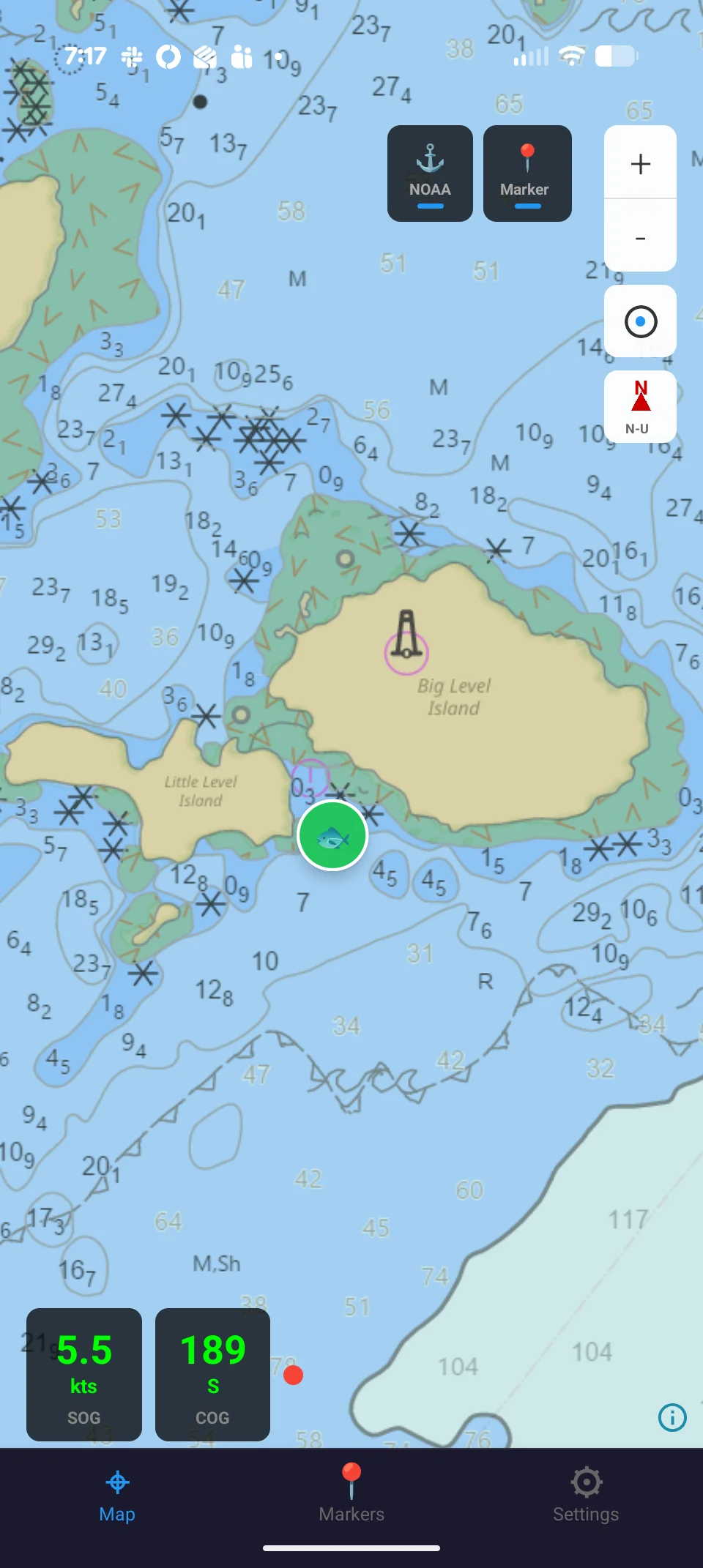
NOAA Charts
Official NOAA nautical charts with full detail — channel markers, depth soundings, hazards, and more.
Bathymetry Contours*
Underwater depth contour overlays to reveal structure, drop-offs, and the spots fish actually hold. Coming soon as a premium feature.
Markers
Save and organize your favorite fishing spots with custom markers.
GPS Navigation
Real-time position and heading overlay on the chart. Always know exactly where you are on the water.
*Bathymetry contours coming soon as a premium feature.
Why FishHogs?
We think anglers deserve better than a $100/year chart subscription.
$0/year
Free NOAA Charts
NOAA charts are public data paid for by your tax dollars. We use them directly instead of charging you again for repackaged government data.
Why pay $50-100/year for repackaged public data?
Offline-ready
Built for Remote Areas
Charts cache automatically for areas you've viewed. Full downloadable chart regions are coming soon — so you'll never lose your charts when you need them most.
Offline downloads coming in a future update.
Not boaters
Made for Anglers
Depth contours, structure finding, and spot management designed for fishing — not cruising. Every feature earns its place by helping you catch more fish.
No bloat. No marina reviews. Just charts and fish.
Coming soon — premium features
The free tier gives you NOAA charts, GPS, and markers forever. When you're ready for more, an optional premium tier will add:
- +Bathymetry contour overlays
- +Multi-device sync
- +Group sharing — markers, catches, and live position
- +Ad-free experience
Get FishHogs
Available now for iPhone, iPad, and Android.